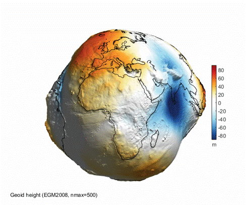
The classical definition of Geodesy is the science concerned with the Shape, Size, and the Gravity Field of the Earth. Geodesy today is much more than that. It is a geo-science that treats the Earth as a complex dynamic system, a body consisting of many layers, surrounded by the atmosphere and the oceans. Geodesy deals with:
• the monitoring of the solid Earth (e.g. tectonic and non-tectonic displacements);
• the monitoring of variations in the liquid Earth (sea monitoring variations in the Earth’s rotation (polar motion, the length of the day);
• determining orbits for scientific satellites (including Earth Observation Satellites);
• monitoring the atmosphere with satellite geodetic techniques (ionosphere, troposphere);
• monitoring the temporal variations in the gravity field of the Earth;
• determining positions, and their changes with time of points on or above the surface of the Earth with the utmost precision.
Geodesy Research Group continues to provide the scientific basis of Navigation by the exploitation of the existing and planned Global Navigation Satellite Systems (GNSS), such as GPS, GLONASS, GALILEO, COMPASS. Its activities have a link to fundamental Astronomy via the global terrestrial reference system. Geodesy is experiencing spectacular growth and each year new frontiers of Earth science knowledge are being explored, such as temporal variations of positions and gravity (land deformations, post glacial rebound, sea level rise, etc.). It is contributing to both everyday mapping and navigation purposes, and to the deeper understanding of our living planet, the Earth and Indonesia as a part of it. Moreover, Geodesy Research group has served society by providing reference frames for a wide range of practical applications, such as navigation on land, sea and in the air, and from construction of infrastructure to the determination of reliable boundaries.
Modern Geodesy does more: with its “three pillars” of geokinematics, Earth gravity field, and Earth rotation, it also provides comprehensive observations of changes in the Earth’s shape, gravity field and rotation. These fundamental geodetic quantities are intimately related to mass transport in the fluid envelope of the solid Earth and its interior, as well as to the dynamics of the Earth System.
Geodesy Research Group are leading to fundamental changes not only in all areas of navigation and transport, but also for applications in process control (e.g. farming, construction, mining, resource management), construction and monitoring of infrastructure (e.g., offshore platforms, reservoirs, dams, bridges and other large engineering structures), surveying and mapping and Earth observation and the crucial part in the assessment of geohazards and anthropogenic hazards, and a role in early warning systems helping to mitigate the consequences of such disasters. Therefore, contributes to increased security, to a better use of resources, and in general to the progress towards the sustainable development, particularly in Indonesia.
